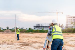
Planning Problems: Old or Inaccurate Surveys
Old or inaccurate surveys – when left uncorrected – can be time bombs waiting to blow up and cause headaches for your development project. Inaccurate surveys can cause a multitude of problems, because:
- Inaccurate figures cause onsite development problems and inaccurate costing
- Incorrect measurements may lead to boundary disputes with neighbouring properties
- Construction problems may occur because of inaccurate figures
- Legal issues may arise over title
It doesn’t have to be negligence or unprofessionalism though that leads to inaccurate surveys. Older surveys may simply be out of date because of alterations to the land that has occurred since the survey took place, including regrading and subtle creep of property boundaries. What are the types of land surveys and what they are used for?
The remedy to old or inaccurate surveys is to engage professional surveyors to carry out a new survey, clarifying terrain, precise boundary location and practical issues for development.
A Fresh Perspective: Engaging a New Surveyor
By engaging the services of a land surveyor, our clients can avail themselves of a range of high-value services:
- Cadastral survey: This is a precise form of a survey that defines property boundaries and can resolve boundary disputes. These surveys are particularly valuable in establishing property rights and can eliminate the need for court action in cases where boundaries are resolved. Old or inaccurate surveys may not account for creeping boundaries (unintentional or not) from shared fences or neighboring renovations.
- Subdivision survey: A subdivision survey is conducted for the establishment of subdivisions, planning, and related purposes. Inaccurate measurements in older surveys may lead to failing to meet particular local council regulations, such as frontage requirements.
- Construction surveys: Old or inaccurate construction surveys may be of particular concern if relied upon when significantly modifying or renovating an existing establishment. A new construction survey will provide new and accurate information on a series of construction-related metrics including specific architectural references and site-building measurements.
- Topographical survey: This is a mapping survey, which may include area mapping, contour mapping and a range of local survey requirements. It’s useful for initial town planning and getting a clearer picture of land configuration. These surveys may include 3D mapping, high-resolution photography and contour maps. Older surveys may not account for these modern technological survey techniques and thus contain less accurate information.
- Site survey: This type of survey relates to a specific site and it may involve a broad range of data. Just about any kind of measurement can be obtained by a site survey, including detailed information regarding the site’s characteristics, elevations, and topography.
Old or inaccurate surveys often cause all manner of headaches for the property developer. The experienced and multidisciplinary team at Arnold Development Consultants can provide you with all the advantages of a new, accurate land survey. Contact us today and save the headaches later!


https://www.deviantart.com/dichvuthetindung
Mar 17, 2020 -
Its not my first time to visit this site, i am visiting this site dailly and take pleasant facts from here daily.
admin
Mar 18, 2020 -
Thankyou for your feedback!